Bob McDavitt’s ideas for sailing around the South Pacific.
Disclaimer: Weather is a mix of pattern and chaos; these ideas are from the patterned world.
Compiled Sunday 21 November 202
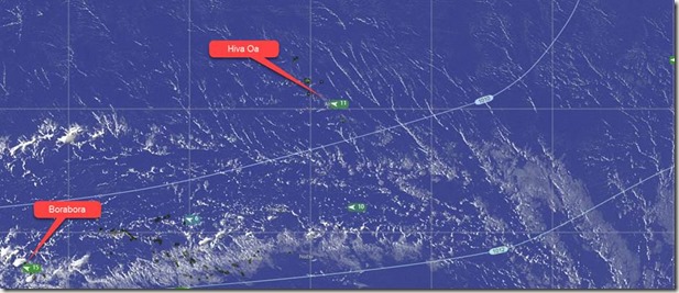
Here is a screen shot from satellite imagery from windy.com (EUMETSAT) showing cumulus cloud lines around Marquesas
It is interesting to compare the patterned long lines of cumulus around the Marquesas with the more chaotic cumulonimbus clouds around Borabora.
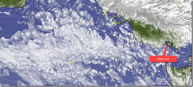
The above image over the Australian bight shows squally showers in a westerly flow south of a HIGH 1025hPa. Note how each shower is surrounded by a moat of sinking air, producing a speckled pattern.
TROPICS
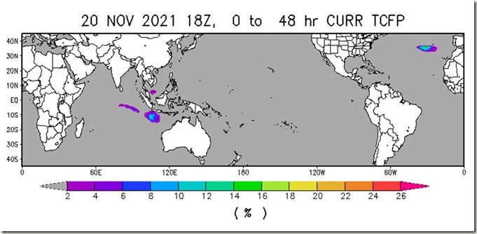
The latest cyclone activity report is at tropic.ssec.wisc.edu and Tropical Cyclone Potential is from
We are continuing with the typical mid-November hiatus with no cyclones around at present.
WEATHER ZONES
Weather Zones Mid-week GFS model showing isobars, winds, waves(magenta), Rain (Blue),
STR (Subtropical Ridge), SPCZ (South Pacific Convergence Zone) and CAPE (in pink)
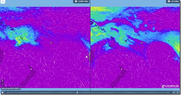
CAPE mid-week as seen by ECMWF and GFS from Predictwind.com, with vastly different ideas this week
.
SPCZ=South Pacific Convergence zone.
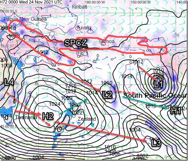
The SPCZ is stretching from PNG across Solomon Islands and northern Vanuatu to Samoa.
A convergence zone over French Polynesia by mid-week is expected to move towards Niue late in the week.
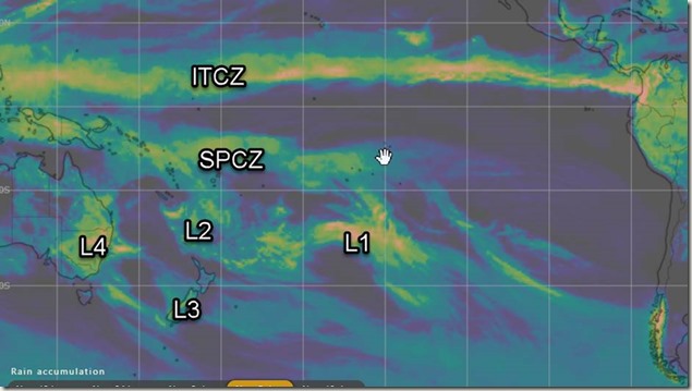
Rain Accumulation next five days from windy.com
HIGHS and LOWS
LOW L1 south of Rarotonga is travelling SE and deepening, stealing the wind from the tropics and moving a convergence zone onto Tahiti by mid-week.
HIGH H1 east of NZ is moving east along 35to 40S faster than L1.
LOW L2 just south of Noumea tonight is expected to travel southeast to east of NZ and then go east following the L1/H1 combo.
LOW L3 is just west of South Island tonight and expected to cross NZ on Monday and then move off to the east southeast.
HIGH H2 is expected to move from Tasmania to central NZ by mid-week and then go northeast, allowing LOW L4 to spread from inland Australia to Tasman Sea/southern NZ by end of the week.
After L2 it looks Ok to sail westwards to Australia or southwards from Fiji to Opua until around Wed 1 Dec.
>>>>>>>>>>>>>>>>>>>>>>>>>>>>>>>>>>>>>>>>>
If you would like more detail for your voyage, then check metbob.com to see what I offer.
Or Facebook at /www.facebook.com/metbobnz/
Weathergram with graphics is at metbob.wordpress.com (subscribe/unsubscribe at bottom).
Weathergram archive (with translator) is at weathergram.blogspot.co.nz.
Contact is bob@metbob.com or txt 64277762212
>>>>>>>>>>>>>>>>>>>>>>>>>>>>>>>>>>>>>>>>>>>>>>>>>>>>>>>
Leave a comment